|
|
Post by OnTheRocks on Apr 18, 2016 13:38:11 GMT -5
Sunday, April 17, 2016 - Water Level = 19.95 We ran this stretch in about 3 hours of paddling plus a couple of stops, so about 4 hours total from the Mill Road/Valley Forest Road put-in to the take-out in Stanley behind the Fire Department. We stopped at Lower Nashwaak Lake which is on river right not far downstream after we put-in. It was 90% frozen over while we were there with 16degC temps. We decided not to run the Irving dam as there was only two of us in a single canoe. Flipping here without a back-up team would make for a soggy afternoon. Unfortunately, there's quite a few blowdowns on either side of the dam portage trail so we improvised and took out on the right, crossed the dam, and put back in on the left. Note to others, bring a saw or axe if you want to help clear some of these out. ![]() 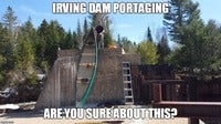 We did take on a bit of water at this level but only because we headed straight for the fun choppy stuff. Nothing strenuous enough to compromise any intermediate paddler. Real fun! CAUTIONARY DRIVING NOTE: There's a large washout on the Mill Road a few kms north of Crabbe Mountain. We took this route on the way out in the evening and had to backtrack through the Crow Hill Road. Nothing a breezy 40km detour over mud, ruts, and potholes couldn't fix.  I'm a map geek so here's a little something extra for those not so familiar with the geography: www.google.com/maps/d/edit?mid=z5rcW1NEc6Ss.kpNzzhtzAu5g |
|
cosmo
Coureur des bois

Posts: 63
|
Post by cosmo on Apr 28, 2016 12:06:38 GMT -5
Sounds like a good trip. Been to the dam on an ATV
|
|


